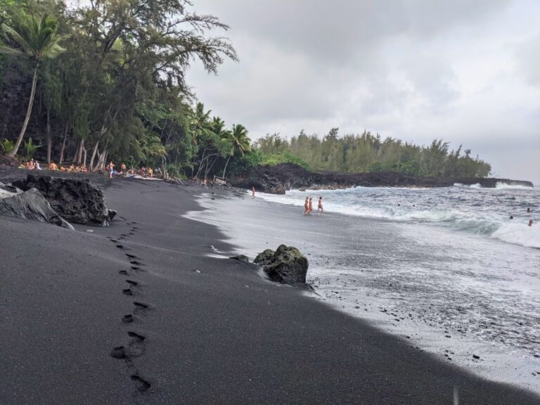
The Kahuku Unit: The Big Island’s Most Underrated Hiking
Hiking the Kahuku Unit is an often overlooked activity on the south end of the Big Island.
However, this extension of Hawaii Volcanoes National Park offers beautiful views, Hawaiian history, and great hiking for all levels.
I lived just a few minutes away from this park and hiked it all the time. It was my favorite place to walk as it is beautiful, but even better, there were never any crowds. In fact, if I saw even one other person it was a rarity.
Quick Facts About the Kahuku Unit

While the majority of Hawaii Volcanoes National Park resides 42 miles away where Kilauea lives, the Kahuku Unit is a separate extension of the park, located at mile marker 70.5 on Hwy 11.
The park covers approximately 20 miles of trails over 116,0000 acres of land. The hiking paths offer varying degrees of difficulty and an ever changing terrain.
These are good trails for families with younger kids, especially the lower elevation hikes.

Dogs are not allowed on the trails.
Biking is allowed on these paths:
- The Palm Trail
- The Old Mamalahoa Trail
- The Kahuku Road up to Upper Palm trailhead
The park is open Thursday-Sunday 8am-4pm.
⚠️ Word to the Wise: Signs throughout the park stress and remind you that the gate shuts promptly at 4pm, so make sure you are out of the park in time.
Entrance into the park is free.
Kahuku Unit Ranger Station
About 0.4-miles into the park from Hwy 11, the paved road leads to a large, red graveled parking lot to the left and an open-air ranger station to the right.
You may stop here for a free map, ask questions, or purchase pamphlets on a couple of the trails (or download them for free).
There are also a couple of boards to read about the history of the Kahuku Unit.
To continue on through the park and access all the trailheads, go past the sandwich board that is usually in the middle of the road at the ranger station and turn left up the gravel Kahuku Road that hugs the Pu’u o Lokuana Cinder Cone.
📍 Feeling overwhelmed planning your Big Island trip?
Let’s work on it together! ➡️
Kahuku Unit Hiking Trails
Pu’u o Lokuana Cinder Cone Trail
Hike length: 0.4 miles
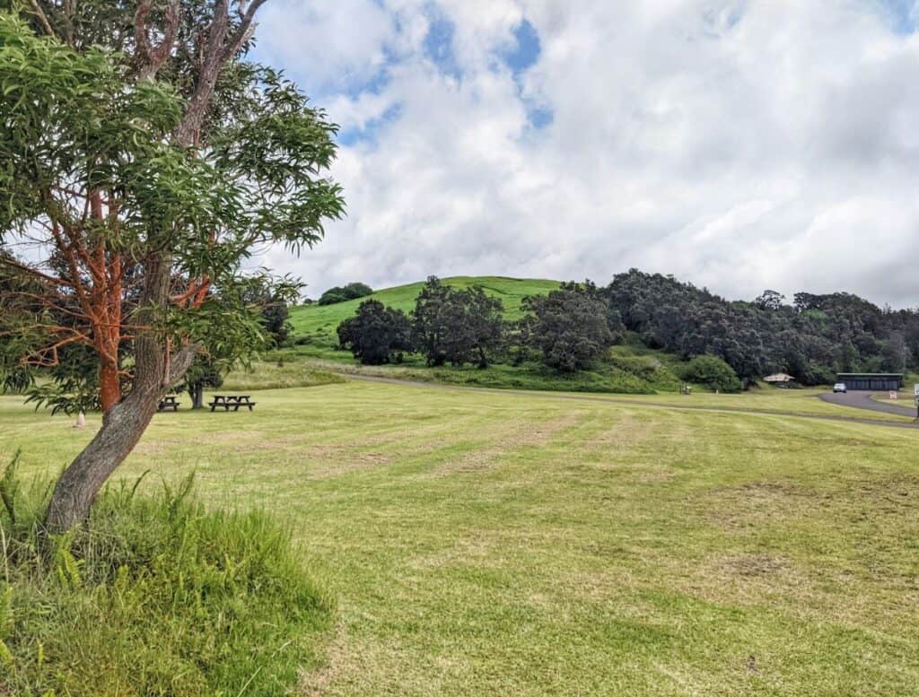
The first point of interest you notice when you get to the parking area is Pu’u o Lokuana, a grassy hilled cinder cone. Park in the red graveled lot and head across the grass field to the base of the hill for the trailhead.
The trail loop is 0.4 miles and only has a 130 foot elevation change but the trail up the cone is brutally steep. I suggest taking the loop clockwise so as to go down the cinder cone instead of up.
The first half of the trail going clockwise parallels the gravel Kahuku Road. You are walking mostly on a mowed grass trail underneath some shade trees. Turn right and you’ll find yourself walking towards the back side of the cinder cone.
Before making that perpendicular right turn from the Kahuku Road, you’ll notice a gravel parking area for the Pu’u o Lokuana trailhead to the left. You could alternatively park here for a shorter hike to the Cinder Cone hike, avoiding most of the inclines.
This is a good option if you just want to pop into the park, see a good view, and leave.
The green knolls and trails on this side of the route is very reminiscent of Hobbiton. Don’t be surprised if you feel inclined to walk barefoot or start feeling hungry for Second Breakfast!

The back side of this cinder cone was used for mining the iron-rich, dark red volcanic dirt. You can see how about half of the cone was mined using explosives and bulldozers.
Remnants of the WWII radar tower base can be found to the left of the trail, half hidden by nature reclaiming its territory after its decommission in 1947.

Hiking to the top of the cone is short but a little steep. Once you reach the top you have a panoramic view of the Ka’u district with ocean below, a view of the South Point windmills, the 1868 lava field to the right, and the park going up the slopes of Mauna Loa.
Take the steep trail down the grassy slope, being careful if it’s wet. It takes you back to the base of the cinder cone where you started.
Pu‘u o Lokuana Trail
Hike Length: 2 miles
Download the Pu’u o Lokuana Trail Guide (or purchase a printed version at the ranger station).

Parking for the Pu’u o Lokuana Trail is at the top of the first hill when you turn up the gravelly Kahuku Road next to Pu’u o Lokuana cinder cone. You’ll need to backtrack down the road a little for the start of the trail.

Pu’u o Lokuana Trail is probably the most diverse trail in the park.
This is a 2 mile loop with 130 foot elevation change that starts among an ohia forest, walking between embedded lava boulders. You’ll cross an old cattle gate into a denser forest for a short spurt. The trail then opens up to a “secret” pasture with rolling green fields and a mowed grass path.

You’ll then hike across the lava flow from 1868. Keep an eye out for lava tree molds. Follow the ahu, small piles of rocks, to guide you in the correct direction; it’s easy to get lost without them.
The end of the lava field meets with an old airstrip from the 1960s. Crop dusters utilized it as they released fertilizer and herbicides on the Kahuku pastures.
I find this to be the most gruesome part of the hike as it is at a slight incline for quite a long ways and there is no shade and the trade winds like to blow here.
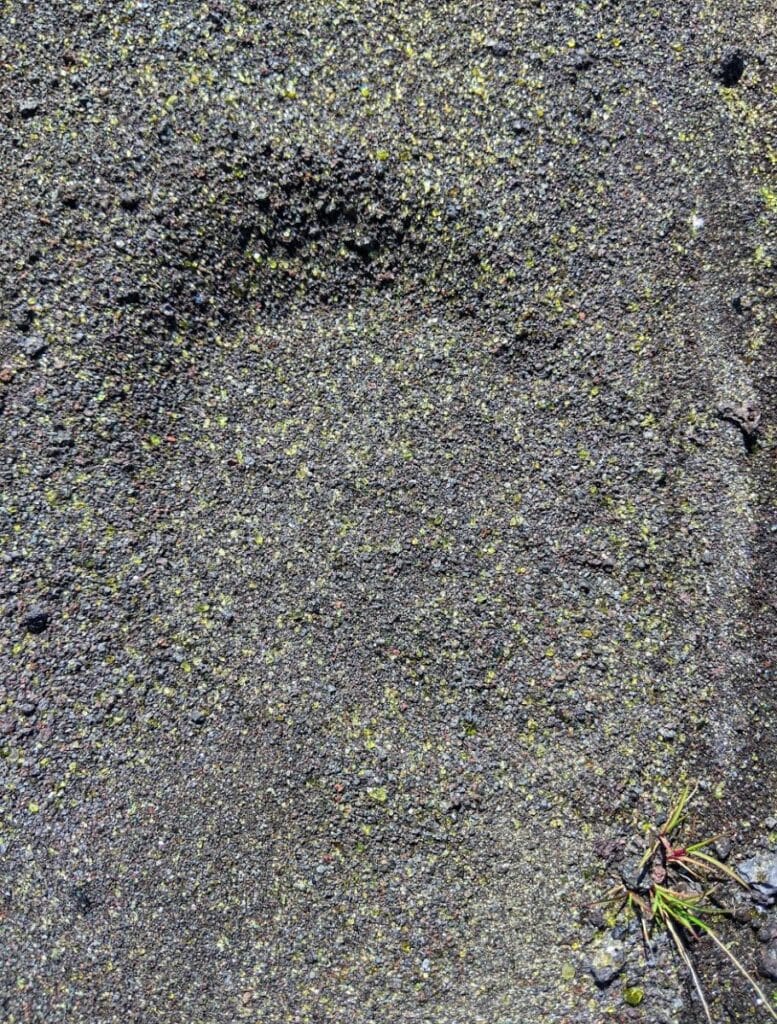
💁♀️ Tab’s Trip Tip: This is a good place to look for glittering olavine bits in the gravel, which is what green sand is composed of. If you want to save yourself a trip to Green Sand Beach you can still boast that you saw green sand. 😛
Once you reach the end of the airstrip you are back at the Pu’u o Lukuana parking lot. Extend your hike to the cinder cone(s) across the road if you wish.
Kamakapa‘a Trail
Hike Length: 0.5 miles
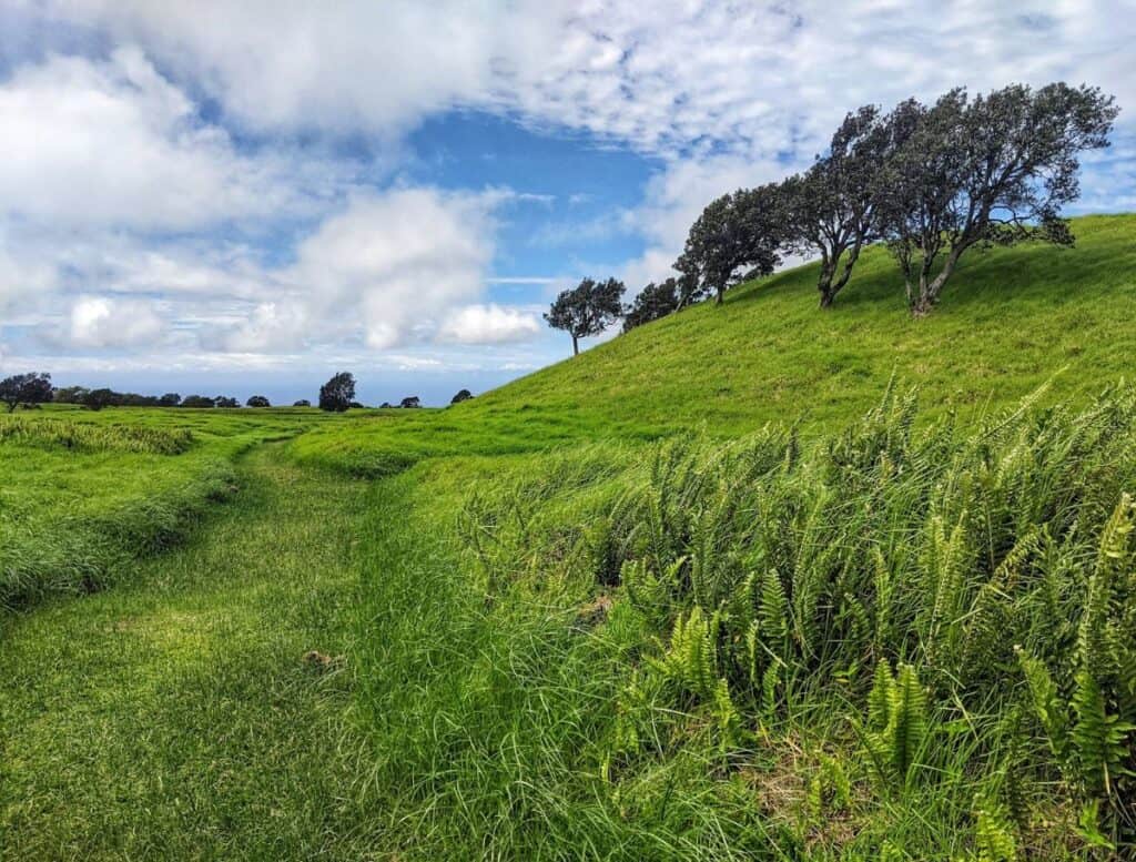
Just a hair further up Kahuku Road from the Pu’u o Lokuana Trail parking lot is Kamakapa’a Trail. This is a 0.5-mile loop with a 40 foot elevation change. Walk on mowed grass up another Hobbit hill, through an expansive meadow, and up a small cinder cone.
The view from the top of this cinder cone is not as striking as the Pu’u o Lokuana cinder cone.
I would say the only reason to bother with this path is if you are looking to tack on extra steps to your hike. It’s easily added to the Pu’u o Lokuana Trail.
Palm Trail
Hike Length: 2.6 miles

Continue up the Kahuku Road and you’ll reach the Palm Trail. The first trailhead is Lower Palm Trail to the left. If you head further up the road you’ll hit Upper Palm Trail.
Start at either trailhead for this 2.6-mile loop trail that is good for hiking or mountain biking. It has a 310 foot elevation change through rolling fields and along the 1868 fissure.
From the Lower Palm trailhead the path starts a little rocky then turns into a long stretch of ups and downs. It then converts to a partially wooded and grassy terrain until it meanders to the Upper Palm trailhead.
To get back to Lower Palm Trail either backtrack or take the gravel road straight downhill. Notice the sparkling gravel, it’s more “green sand”.
Pit Crater Trail
Hike Length: 2.4 miles

A little over 3 miles up the gravel road is the Pit Crater trailhead on the right. This is a steep hike up old pasture roads that brings you to a forested volcanic pit crater.
Most of the 2.4 mile hike is uphill with a 1,165 foot elevation gain. Not far up you’ll see the Pali o Ka‘eo Trail to the left, an alternative route to the crater pit.
Soon after you’ll cross an ROD quarantine gate to decontaminate your shoes about 0.75-miles in.
You know you are nearing the crater when the trail ends at Lower Glover Trail, yet another route option to the pit. Turn right for just another couple tenths of a mile or so and you’ll see the turn off for the crater.
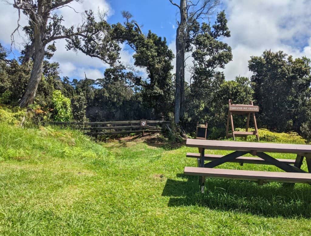
Once you reach the pit crater, you are rewarded with an excitingly dangerous wooden fence preventing you from falling into a giant hole in the ground.
Look down on lush treetops and see sheer rocky cliffs that form the crater. Unfortunately, for how long of a hike it took to get here, the view is a bit underwhelming, imo.
There is a picnic table to eat a snack or lunch and recoup before heading back down the mountain.
Pali o Ka‘eo Trail
Hike Length: 1.6 miles
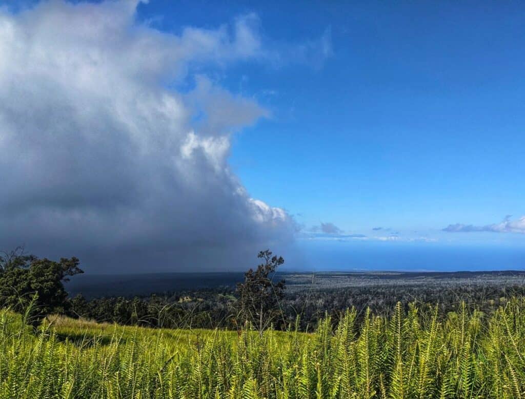
Kahuku Road ends after a total of 4 miles at an ROD quarantine gate and small parking lot. Here you can access a network of trails that go further up the mountain.
The Pali o Ka’eo Trail is to the right of the ROD quarantine gate. The trail takes you along a vista view of the Ka’u coast.
This mostly straight path rollercoasters uphill and downhill more times than I cared to count.
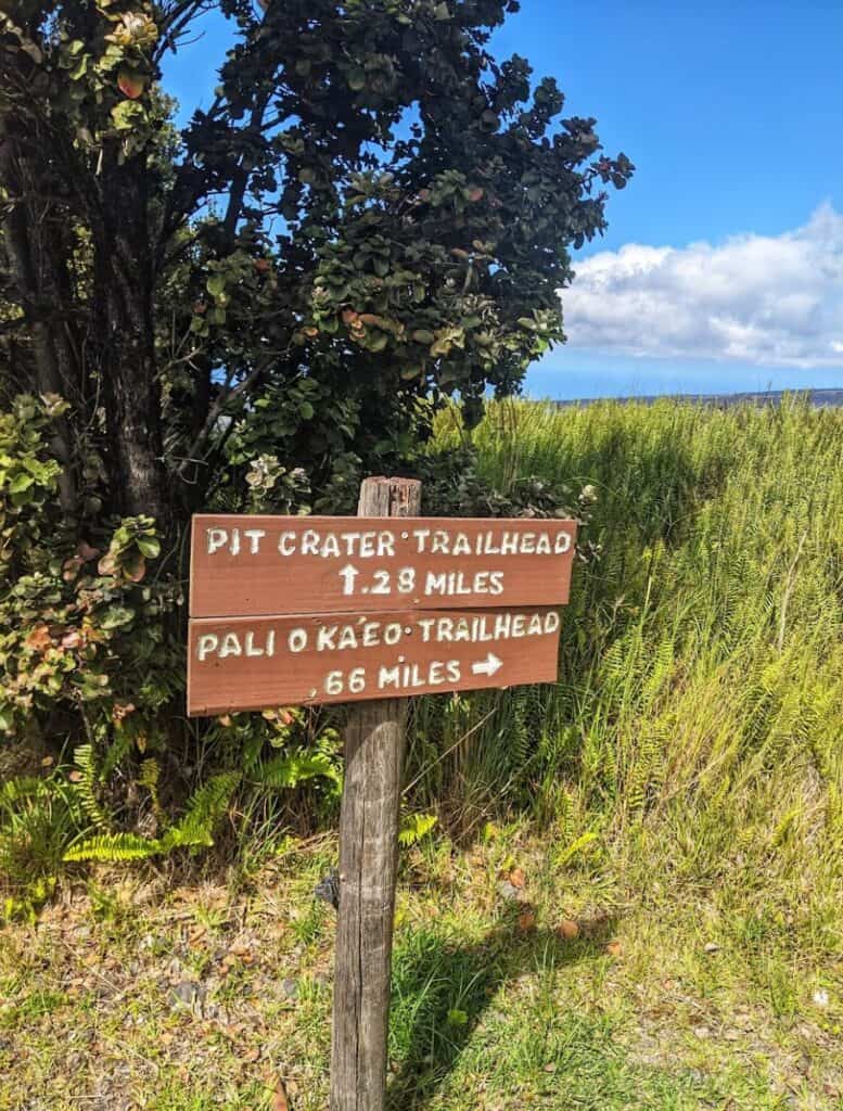
When it comes to a T in 0.8-miles you have hit the Pit Crater trail. Head uphill about 2.2 miles to see the crater or go downhill to make your walk into a 2.1-mile loop with 410 feet elevation change by walking to the Pit Crater trailhead then up the gravel road back to the parking lot.
Trails Beyond the ROD Quarantine Gate

From the ROD quarantine gate at the end of Kahuku Road is a culmination of trails to “choose your own adventure” but they all begin with the same 1.2-miles uphill.
The path (let’s call this mainway the ROD Trail for ease of reference) begins right away at a steady incline on a gravel road. If you have 4WD you can drive through the gate, otherwise you’re walking it.
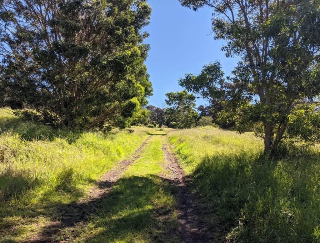
Walk through an open forest with spaces for the trees to breathe and tall grass carpet the ground beneath them.

Keep an eye out for koa trees, whose wood is used by artisans that craft works of art, instruments, and furniture.
The Glover Trail
Hike Length: 5.6 miles
Download the Kahuku Forest Trail Guide (or purchase at the ranger station). Please note: the guide is a little outdated as it has you starting at the Glover Trail parking lot which currently is grown over and no longer open. Start the hike further up the ROD Trail.

There are two trailheads for the Glover Trail: Lower Glover and Upper Glover, 0.8 miles further up the ROD Trail. (ignore the overgrown old Glover Trail parking lot; continue past it until you see a sign marking the Glover Trail)
The Glover Trail loop is about a 3.2-mile loop from the Lower Glover trailhead, making the total roundtrip mileage from the ROD quarantine gate 5.6 miles.
Glover Trail is dissected in the middle with a 0.5-mile shortcut between the Upper and Lower trails if you wish to shorten the loop. Lower Glover Trail also connects with the Pit Crater Trail before bringing you to the Forested Pit Crater.

About 0.5 miles up from the crater is an out-and-back detour trail that almost brings you to a lava flow from 1926 and ends with a giant ʻōhiʻa tree that is probably over 200 years old. This is an extra 1.6-miles roundtrip.
Continue along Upper Glover Trail until you meet up again with the ROD Trail. If you turn right you’ll join the Kona Trail. Turn left for a 2-mile trek downhill back to the parking lot at the ROD quarantine gate.
The Kona Trail
Hike Length: 7 miles
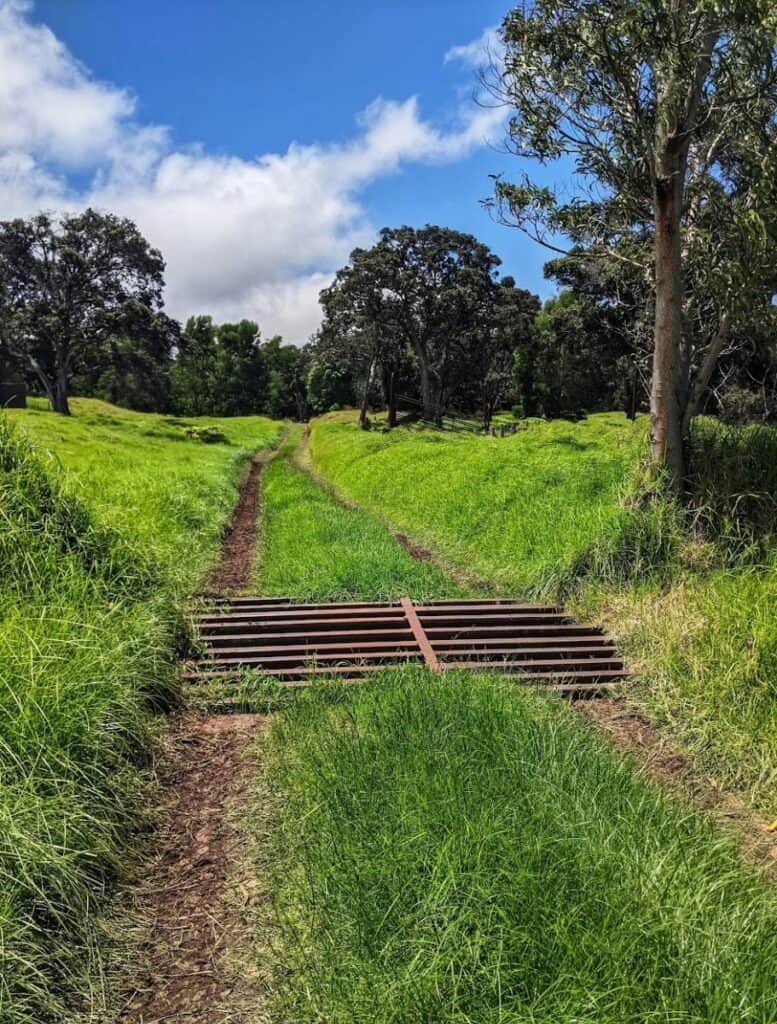
Again, head up 1.2 miles on the ROD Trail to get to the Kona Trail, which will be on the left. The Kona Trail is a 4.6-mile loop, making it the longest single trail in the park if you don’t add in other trails.
This hike takes you amongst pasture lands from the days of Kahuku ranching. You are sure to spy some left behind equipment.
About halfway through the trail you’ll walk across the 1887 lava flow.
At 3.8 miles you’ll meet up with the ROD Trail and can head back down to the parking lot 2 miles away or tack on the Glover Trail.
Trail Outside of Kahuku Unit Gates
Old Mamalahoa Trail
Hike Length: 3 miles
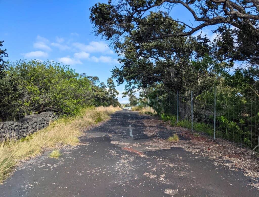
Outside of the Kahuku Unit’s main park entrance is the Old Mamalahoa Trail, a paved, 1.5 miles out-and-back trail that used to be the Mamalahoa Highway.
This gated trail is open all day, every day at either mile marker 71.5 or 73.
There are no signs indicating parking for either end. They look like paved pullouts against a chain-link fence and gate.

The mostly flat, broken asphalt trail crosses both the 1868 lava flow and the 1887 lava flow. You’ll see lava rock walls, ohia trees, and views of the Kahuku Unit.
There is little respite from the sun so consider hiking this trail early in the morning.

Join thousands of other visitors and locals to discover the best things to do on the Big Island!
🌺 New activities posted daily
🌺 Upcoming events not to miss
🌺 Ask questions about your trip
History of the Kahuku Unit
Evidence of early Hawaiians in the Kahuku Unit date back as far as 1400, though I’m sure they were around before then. The surrounding Ka’u district, and presumably Kahuku, was used as farmland for sugar cane, bananas, and the purple sweet potato.
Kahuku was also a prime spot for hunting pigs and goats.
After Kamehameha the Great defeated his cousin, Keōua, supporters of Keōua retreated up into the Kahuku lands.
Captain George Vancouver introduced cattle to the Big Island in 1793. They soon grew into uncontrollable numbers so Mexican cowboys were hired around 1830 to deal with them. Ranches were built all over the island, and Kahuku Ranch was the largest of them all at one point.
In 1868, one of the Big Island’s biggest volcanic eruptions occurred. A fissure opened in Kahuku Ranch spewing lava fountains 500-1,000ft high. The main lava flow was a mile wide.
The home of the owner of the Kahuku Ranch at the time, Robert Brown, was destroyed as well as 4,000 acres of the ranch.
Parker Ranch from up in Waimea owned the Kahuku Ranch between 1912-1947.
During World War II the Pu’u o Lokuana Cinder Cone held a US marine secret radar station, an emerging new technology for detecting planes and ships.
For the rest of the century the ranch changed owners multiple times until 2003 when Kahuku Ranch became public land and added to Hawaii Volcanoes National Park.
Rapid ʻŌhiʻa Death (ROD)

The ʻōhiʻa tree is a common plant found in Hawaii. Its biggest indicator is the bright red lehua flower that kind of looks like a mini sea anemone.
Legend of Lehua
Legend has it that Pele, goddess of fire, fell in love with a handsome human warrior and asked him to marry her. However, Ohia was already taken, for he was engaged to his love, Lehua. He turned down the offer and Pele was so enraged that she turned Ohia into a tree.
When Lehua found out about her fiance she was heartbroken. The gods felt sympathy towards Lehua and thought it unjust for her and Ohia to be separated. To help the lovers out, they turned Lehua into a beautiful flower onto the Ohia tree so that the two would be joined together forever.
A major concern in the park is the spreading of Rapid ʻŌhiʻa Death (ROD), a fungal disease that clogs the vascular system in the ʻōhiʻa tree, preventing it from getting water, and thus killing it. ROD is primarily on the Big Island, though it has also been found on other Hawaiian islands.
To help lessen the spread of ROD around the Kahuku Unit and the rest of the Big Island, all the trailheads have a sanitation station.
There is a shoe brush to wipe your shoes before and after hiking. Sometimes there is also a spray bottle with a rubbing alcohol mixture to sterilize your shoes.
What to Do After Your Hike
After hiking the Kahuku Unit, check out these other things to do in the area!
Eat the best malasadas on the island at Punalu’u Bake Shop, sample Ka’u coffee at Paradise Meadows or Mirandas Coffee Farm, jump off the cliffs at South Point, and more.
🌋 Continue exploring more Hawaii Volcanoes National Park here! >>